Bédar
 | BÉDAR |  |
||||||||||
| Información | ||||||||||||
|---|---|---|---|---|---|---|---|---|---|---|---|---|
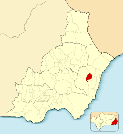
| Fundación: | Siglo XVI | |||||||||||
| Coordenadas: | 37°11′27″N 1°58′50″O | |||||||||||
| Altitud: | 389 m | |||||||||||
| Comarca: | Levante | |||||||||||
| Distancia a la capital: | 77 km | |||||||||||
| Gentilicio: | Bedarense | |||||||||||
| Patrón: | San Gregorio Magno | |||||||||||
| Patrona: | Virgen de la Cabeza | |||||||||||
 |
||||||||||||
operating instructionsVarious functions are available as part of the map. mouse/touch operation
keyboard operationKeyboard operation becomes available after activating the map using the tab key (the map will show a focus indicator ring).
It's possible that some of the functions or buttons describe above have been disabled by the page author or the administrator
|
||||||||||||

Warning, the folder related to namespace bedar:galeria does not exist.