
Herramientas de usuario
Barra lateral
senderos:apie:la_merendera-calar_alto
La Merendera-Calar Alto
| ** La Merendera-Calar Alto ** | |
 |
|
| Lugar: | Gérgal, Bacares |
|---|---|
| Distancia: | 11,5 Km (ida y vuelta) |
| Duración aproximada: | 3,5h |
| Dificultad: | Media |
| Recorrido: | Circular |
| Medio de transporte: | A pie |
| GPX: | Descargar GPX |
| Más detalles: | Senderos de Almería |
Mapa
operating instructions
Various functions are available as part of the map.
mouse/touch operation
- moving by grabbing the map with a mouse-click you can move the map around
- overview map using the < button in the bottom right of the map you can expand an overview map
- zooming in and out using the + and - buttons in the top left of the map you can obtain more or less detail in the map
- switching themes or maps clicking on the ≡ icon on the right-hand side of the map you can view and select available maps and themes
- retrieving information the map may contain elements that contain more information, by clicking these a popup will show this information
- fullscreen display using the ⛶ button the map can be maximized to fullscreen display, use the ▢ button to return to page display.
keyboard operation
Keyboard operation becomes available after activating the map using the tab key (the map will show a focus indicator ring).
- moving using the arrow keys you can move the map
- overview map using the + button in the bottom right of the map you can expand an overview map
- zooming in and out using the + and - buttons in the top left of the map or by using the + and - keys you can obtain more or less detail in the map
- switching themes or maps clicking on the ≡ icon on the right-hand side of the map you can view and select available maps and themes
- retrieving information the map may contain elements that contain more information, using the i key you can activate a cursor that may be moved using the arrow keys, pressing the enter will execute an information retrieval. press the i or the escape key to return to navigation mode
- fullscreen display using the ⛶ button the map can be maximized to fullscreen display, use the ▢ button to return to page display.
It's possible that some of the functions or buttons describe above have been disabled by the page author or the administrator
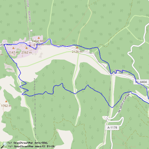
| id | Símbolo | Latitud | Longitud | Descripción |
|---|---|---|---|---|
| La Merendera-Calar Alto | ||||
 |
 |
GPX track: merendera-calar alto | ||
senderos/apie/la_merendera-calar_alto.txt · Última modificación: por bastetani